Between 1987 and 1992 the Raleigh Historic Districts Commission employed consultants to survey buildings in Raleigh. The commission originally gave permission for portions of this material to be used on the Raleigh City Museum website. In 1992 as a museum volunteer I converted the original text documents to web pages, and took new digital photos for the web of the buildings mentioned in the material that follows.
Later revisions of the Raleigh City Museum dropped these web pages, but they are preserved here on my personal website.
The work of surveying Raleigh's architecture was broken into four components:
Preliminary research for Phase 1 was conducted by Richard Mattson. The survey itself was undertaken by a team lead by Elliott K. Wright that included Bruce Kalk, Joyce Marie Mitchell, and Terri Myers. Phases 2 & 3 were conducted by Helen P. Ross. Ruth M. Little, Ph.D. was the researcher for Phase 4.
 The survey of Raleigh's African American communities included fifty-six oral
histories and resulted in the documentation of eight distinct areas: College Park,
East Raleigh-South Park, Fourth Ward, Idlewild, Method, Nazareth, Oberlin, and
Smoky Hollow. More than thirteen hundred buildings were recorded, and the
East Raleigh-South Park neighborhoods were placed on the National Register of
Historic Places. As with all the other Raleigh survey work, the bulk of the
documentation is in the form of survey records on file with the
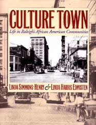
State Historic Preservation Office. Culture Town: Life in Raleigh's
African American Communities (ISBN: 0-9635677-0-5), by Linda Simmons-Henry
and Linda H. Edmisten, was published by the Raleigh Historic Districts
Commission in 1993 to describe the project and share its findings. The
large format (8-1/2" x 11") 180 page book contains more than 160 black
and white contemporary and historic photos, some never before published,
and includes a 22-minute cassette tape. It is available
from the Raleigh Historic Districts Commission office
(919/832-7238) (also the Planning Dept.).
The survey of Raleigh's African American communities included fifty-six oral
histories and resulted in the documentation of eight distinct areas: College Park,
East Raleigh-South Park, Fourth Ward, Idlewild, Method, Nazareth, Oberlin, and
Smoky Hollow. More than thirteen hundred buildings were recorded, and the
East Raleigh-South Park neighborhoods were placed on the National Register of
Historic Places. As with all the other Raleigh survey work, the bulk of the
documentation is in the form of survey records on file with the
State Historic Preservation Office. Culture Town: Life in Raleigh's
African American Communities (ISBN: 0-9635677-0-5), by Linda Simmons-Henry
and Linda H. Edmisten, was published by the Raleigh Historic Districts
Commission in 1993 to describe the project and share its findings. The
large format (8-1/2" x 11") 180 page book contains more than 160 black
and white contemporary and historic photos, some never before published,
and includes a 22-minute cassette tape. It is available
from the Raleigh Historic Districts Commission office
(919/832-7238) (also the Planning Dept.).
During a two year period Helen Ross evaluated more than 3100 properties. Much of this work was done via bicycle and was cause for an article in the News & Observer. The material included here consists only of the summary material; the complete survey records are on file at the State Historic Preservation Office. The two primary portions of the summary material are an essay on the history of Raleigh architecture and a study of buildings by property type (residential, commercial, industrial, etc.).
Essay on the Architecture of Raleigh (1880-1970)You can click on any photo to see a larger image. The original National Register listings are included for completeness, NR List (1992), NR Study List (1992), as well as some aids to locating the individual properties studied: Index by Survey area, Alphabetical Index.Multiple Property Types Documentation
The Phase 4 area is the suburban area of the city, comprising a broad band between the outer limits of the 1920s suburbs out to the 1988 city limits. Ruth Little's report is presented here:
Phase 4 Final Report
 Between 1988 and 1991, the Wake County Planning Department surveyed the areas of the
county outside the city's 1988 boundaries. Information about the survey is available
on the county's
Historic Preservation web page.
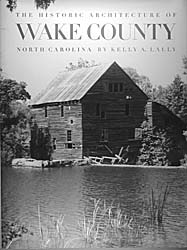
Kelly Lally's survey was published by Wake County Government in 1994.
The large format (8-1/2" x 11") 437 page book, titled The Historic Architecture of
Wake County, North Carolina (ISBN: 0-9639198-0-6), has black & white
photos and maps covering sixteen townships. It is available
from Capital Area Preservation (919/833-6404).
Between 1988 and 1991, the Wake County Planning Department surveyed the areas of the
county outside the city's 1988 boundaries. Information about the survey is available
on the county's
Historic Preservation web page.
Kelly Lally's survey was published by Wake County Government in 1994.
The large format (8-1/2" x 11") 437 page book, titled The Historic Architecture of
Wake County, North Carolina (ISBN: 0-9639198-0-6), has black & white
photos and maps covering sixteen townships. It is available
from Capital Area Preservation (919/833-6404).