Methodology
This architectural and historical inventory of downtown Raleigh is a catalogue of the city's development between 1890 and 1941. Upon completion of the survey component approximately 3,100 properties were fully documented in the twenty-two month period between October 1989 and August 1991. Thirty rolls of color slides and over 300 rolls of black and white, thirty-six exposure film was shot. Phase I was composed of ten areas which had been identified as being the most fragile and endangered. They were: Downtown, Ashe-Cox-Morgan Avenues, Old Northwest Quadrant, College Crest, Wilmont, Fairmont, Mordecai, Oakdale, Roanoke Park and Georgetown. Increasing development pressure from public and private concerns may eradicate much of the built environment of early twentieth century Raleigh. As the new century fast approaches it is important to rediscover the growth patterns of the capital city.
Raleigh's early and mid twentieth century residential growth were the focus of the second year of the Raleigh Downtown Architectural Survey. The additional ten survey areas were Vanguard Park, Hayes Barton, Bloomsbury, Anderson Heights, Budleigh, College View, Watson Park, Longview Gardens, Caraleigh and Fuller Heights. Predominantly occupied by white and middle income persons, with the exception of Caraleigh, a mill workers' community, Raleigh's suburbs reinforced the mores and values of the inhabitants. Thus, for example, just before World War II, developers of Anderson Heights were still following tried and true formulae from the 1920s. A November 1940 News and Observer advertisement proclaimed that the Federal Housing Authority planned and approved Fallon Subdivision "has property which is covered by proper restrictions for the protection of homeowners (and) is the only development in suburban Raleigh that has completely installed all necessary improvements before offering the lots to the people."
Following the North Carolina Historic Preservation survey manual guidelines, the study and documentation of the Phase I survey areas was straightforward. All historic resources were documented with a completed computer form, photographs, descriptive and analytical entry, and mapping. In recording clustered urban sites, a green (multiple structures) computer form was used for an entire block face. An urban block face contained between 4 to 25 buildings on one side of the street. However, Phase II methodological procedures varied slightly from the previous year in order to maximize the usefulness of the data. Neighborhoods were documented at one of two levels of intensity: "extensive" and "overview". The first category encompassed all building types, regardless of age. (This is especially pressing in light of the current trend of some homeowners who radically change the original form of pre- and post- World War II structures.) The second category identified an area with a thumbnail sketch of its development history, accompanied by several streetscape photographs. Another change in the recordation was greater utilization of the (green) multiple structures forms. More information was amassed on a single form -- a street or block as well as single block faces and the documentation of each on a separate sheet. Individual (yellow) forms were completed for the most significant properties. An exception to this format was Hayes Barton due to its high degree of integrity and significance. Here, the dwellings that possessed the most unique features were catalogued individually, but all properties were surveyed on green forms as well and an inventory list was prepared.
With the exception of several significant post World War II structures, everything inventoried is fifty years or older. The survey was also limited to a man-made boundary, the circumferential freeway, the Cliff Benson Beltline. In order to maintain a tight schedule it was agreed that all previously inventoried properties and districts would not be restudied. Already the documentation of the downtown business district has aided city planners in the formulation of a comprehensive study which will decide the future image of the city.
A few additional individual properties were not surveyed. These include the Thad Eure, Sr. House on New Bern Avenue, the Clarence Poe House also on New Bern Avenue, the Coley Farm compound behind the United Carolina Bank, off Glenwood Avenue, and the WPTF Radio Station
 |
Before the Raleigh project, Helen P. Ross, the principal investigator, received a Master of Arts degree in American Civilization from the George Washington University. Miss Ross has an extensive background in historic preservation including a stint with the City of Alexandria, Virginia, where she helped in the re-survey of the Old Town Historic District.
The 1989-1991 Raleigh Building Survey focused on areas not recorded in previous surveys of the city. These earlier projects were the 1978-1979 Raleigh Architectural Inventory conducted by Linda Harris and Mary Ann Lee which selectively documented key pre-1929 buildings; the North Carolina State University campus, (previously surveyed by David Brown); the early twentieth century suburbs Glenwood, Boylan Heights and Cameron Park, and the Moore Square area (recorded by Charlotte V. Brown in the early 1980s); and the 1988-1990 African-American Survey which covered the smallest and the largest neighborhoods where pre-World War II blacks resided.
The History and Architecture of Raleigh, North Carolina (1880-1970)
The expansion of Raleigh during the early twentieth century has created a city with two faces, an urbane and sophisticated downtown circled by a ring of introspective neighborhoods. In both spheres, the architecture is traditional in form and style. Although the character of the city is conservative, two aspects of its twentieth century development are decidedly progressive. The continual upgrading of the water system and the intensification of the railroad networks were two keys which permitted the city to maximize on its location as a distribution center. With another function besides government and education the city attracted a diversified labor force. As Raleigh became more populous, residential development began to spread out in all directions. The neighborhoods' architecture reflected mostly conservative styles and reinforced the social and cultural divisions in Raleigh society.
The Late Nineteenth Century: 1880-1900
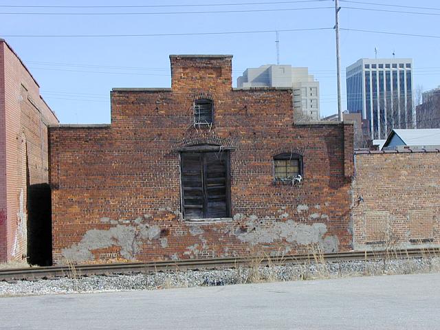
After the city of Raleigh was surveyed and planned by William Christmas in 1792, it remained the size of one square-mile until 1857 when the city limits were extended approximately three blocks on all sides. [1] Up to that time Raleigh's commercial expansion had been slow. Two railroad lines complemented each other by 1855, the Raleigh and Gaston Railroad and the North Carolina Railroad. The 1872 Birdseye View of the City of Raleigh shows the arrangement of the community shortly after the Civil War. The commercial section emerged along Fayetteville Street, just south of the State Capitol. Foundries, factories and warehouses were located near the tracks on the north and west sides of town. The remaining spaces inside the city limits were occupied with boarding houses, private residences, and three hotels inhabited by poor and wealthy, black and white, young and old. In the final quarter of the nineteenth century, Raleigh's public and private sector leaders were determined to improve the cityscape to their advantage. Proximity to surface transportation spelled success for merchants in the form of shops and warehouses, stables and hotels. City alderman established streetcar lines and community leaders enlarged churches. Growth occurred in all directions as employment opportunities appeared in the form of the Water Works, 1887 (1800 block of Fayetteville Street), the North Carolina Agricultural Experiment Station, 1886 (2714 Vanderbilt Avenue), the Dormitory and Factory for the North Carolina School for the Blind and Deaf, 1898 (Caswell Square), and the Caraleigh Cotton Mill, 1891-1892 (421 Maywood Avenue). Businessmen endeavored to make Raleigh a prosperous city before the turn of the twentieth century.
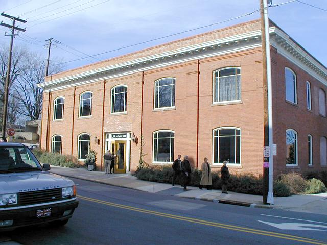
A critical element to Raleigh's future growth was the provision of a stable, potable water supply. From its founding in 1792, until the municipal water works went into operation, Raleigh depended on springs, wells and cisterns for its water supply. The water works complex (1810 Fayetteville Street) was designed by civil engineer Arthur Winslow and constructed in 1887 by the Raleigh Water Works. The red brick, slate covered, gable-roofed pumping station
 |
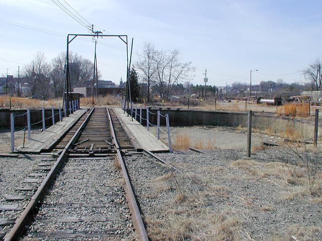
Besides the provision of water another amenity which was lauded by Raleigh's public and private sectors was transportation. The electrified streetcar in the capital city did not materialize until 1891, but for five years before this, mule-drawn, open- sided vehicles ran short routes in the square mile. Although Raleigh was one of the first cities in North Carolina to possess the technology for the creation of electric power, the City's system foundered repeatedly. In the 1890s and 1900s, streetcars, street lighting, and the power for newly located textile mills were the only uses to which electricity could be applied. Streetcars were a handy and relatively inexpensive justification for electrification requiring only a few large motors and auxiliary equipment plus the cost of generators and trunk lines. [3] The electric streetcar revolutionized transportation technology. Traversing and skirting the central business district, the tracks opened up a suburban ring and enabled the electric trains to travel fast, about four times faster than the horse-drawn systems they replaced. By 1910, the Raleigh routes consisted of a downtown, a ten block circulator and three radial routes to the north, east, and west. Within the city limits main arteries such as North Blount, East and West Hargett, Fayetteville and Hillsborough streets had tracks embedded in them. The longest distance trips were west, along Hillsborough to the N.C. College of Agriculture and Mechanic Arts campus and north, along Glenwood Avenue to Bloomsbury Park. [4]
Other prime beneficiaries of the cheap electric power were the textile mills that settled in the city during the final decade of the nineteenth century. The founders of six new mills took advantage of nearby surface transportation systems and the opportunity to purchase power rather than generate it on site. One of the earliest and largest of such structures is the Caraleigh Cotton Mill
 |
Around the time that the Caraleigh mill began operations, the
company also erected dwellings to house all of the mill workers,
mainly along Thompson and Montrose streets.
 |
 |
|
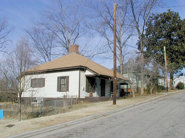
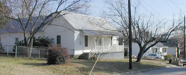 The foremen lived in
a single-family units which were one-story, frame, gable roofed
dwellings, while mill hands resided in single-story, brick,
hip-roofed duplexes. The floor plans were similar with three rooms
and a rear back porch.
The foremen lived in
a single-family units which were one-story, frame, gable roofed
dwellings, while mill hands resided in single-story, brick,
hip-roofed duplexes. The floor plans were similar with three rooms
and a rear back porch.
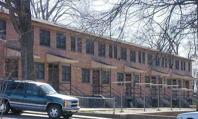
There was no indoor plumbing until the mill village was incorporated by the City of Raleigh on January 1, 1958. Backyard outhouses were a common sight as were the water pumps in every front yard. The narrow tree-lined streets were unpaved, and deep runoff ditches ran adjacent to them. [6] The Caraleigh Cotton Mill, is the only textile facility that still functions in Raleigh, and its housing composes the last surviving mill village in the city.
In addition to being North Carolina's capital, Raleigh in the late nineteenth century had emerged as an educational center. [7] As early as 1872, Leonidas L. Polk had proposed the establishment of an agricultural and industrial college. Five years later, in 1877, the N.C. Agriculture Experiment Station was founded. The Experiment Station was joined with the North Carolina College of Agriculture and Mechanic Arts when the college was established March 7, 1887, by the General Assembly. The first classroom building, Holladay Hall
 |
 |
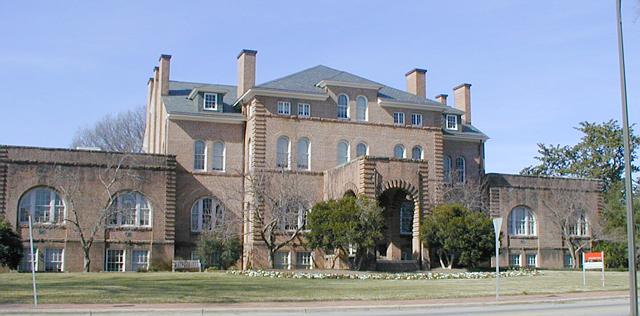
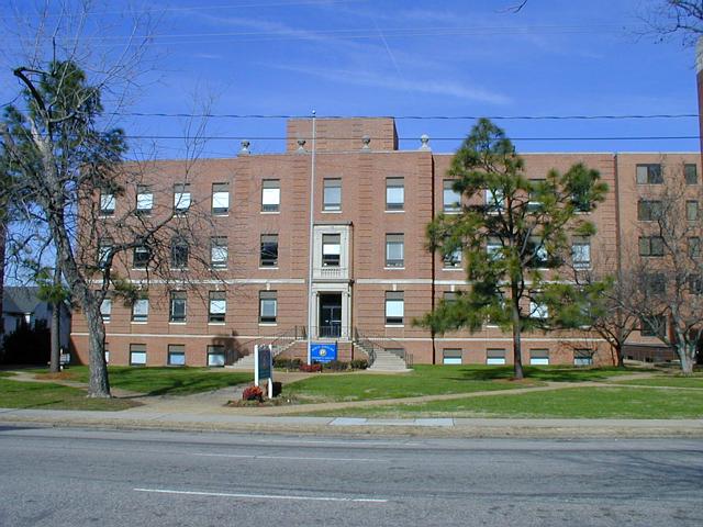
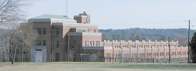
One of the earliest public education facilities in Raleigh was the N.C. School for the Blind and Deaf (1848). Located on Caswell Square, the institution at the turn of the twentieth century boasted nine buildings. One of the final stages of construction occurred in 1898 with the dormitory and the broom and mattress shop. The dormitory
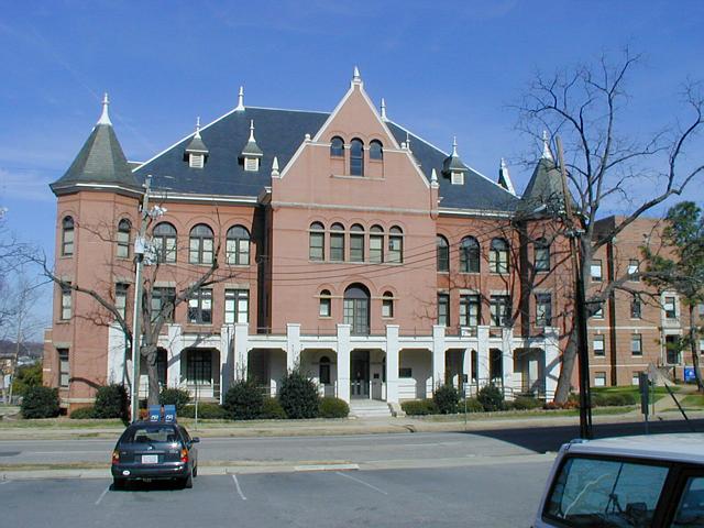 |
 |
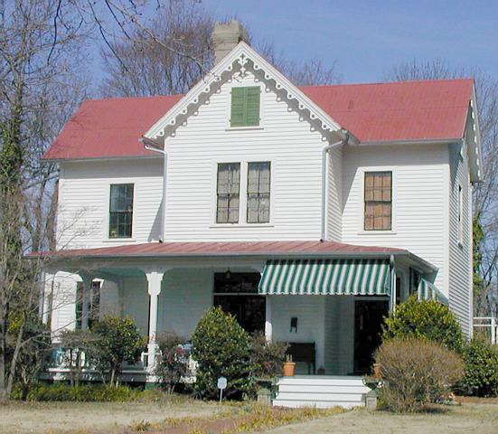
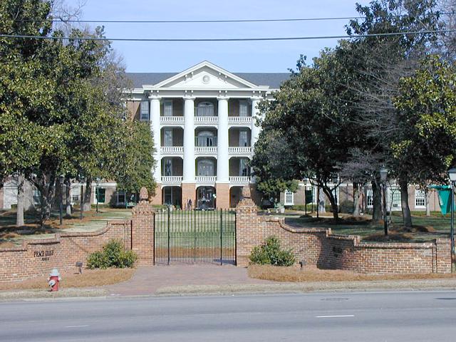
In the closing decades of the nineteenth century, a few blocks to the east of the N.C. State for the Blind and Deaf, some of the city's leading educators such as Needham Broughton and Cary J. Hunter lived in Oakwood, an area created from wooded land northeast of the city. The Oakwood neighborhood borrowed its name from the nearby cemetery, it was the first district in Raleigh solely created to be an exclusive residential suburb. Many prominent citizens, particularly George V. Strong and Marcellus Parker built and lived in the fine one-and two-story, frame and brick Victorian dwellings which reflect the primarily middle-class tastes of the era. [10] Residents of the neighborhood were employed in the banking and law firms in the central business district, the local and state governments, and the educational facilities of Peace College, St. Augustine's College, the Baptist Female University and the Raleigh Male Academy (demolished). Oakwood remained a bastion of the middle class through the early twentieth century.
 |
 (St. Agnes Hall renovation) |
Another district, "Smoky Hollow", was located in and beyond the
north city limits. The area had existed before the Civil War
but grew in the 1870s and 1880s. The predominantly working class
residents, both black and white, were employed by the nearby
industries. These included the Raleigh and Gaston Railroad's
machine shop, round house
, foundry, and sawmill, the Standard Oil
Company, the Foster Brothers Cotton Compress, the Ellington
Royster and Company planing mill and the Ruffin Rolies furniture
factory. Although demolished in the 1960s, Smoky Hollow, which
received its name from the train smoke that hung over the
bottomlands, was a vibrant, mixed use neighborhood. [11]
 |
In the southeast and southwest sections of the city, African-American neighborhoods such as Idlewild, College Park, Third and Fourth wards were experiencing tremendous expansion. The educational institutions such as Shaw University, St. Augustine's College and the Deaf and Dumb Asylum for Negroes attracted increasing numbers of students, staff and faculty to the area. Laborers and skilled workers were also drawn to Raleigh in search of employment. The domiciles that were constructed by and for these people are typical of those found throughout the Southern region of the country. The one and two-story frame houses situated in Raleigh's African-American neighborhoods include Queen Anne cottages, shotguns, and Triple-As.
As the nineteenth century drew to a close, Raleigh's urban center and increasingly segregated neighborhoods reflected the emergence of a modern Southern capital. With a utility infrastructure firmly entrenched, water, electricity and inexpensive transportation provided better living conditions. Proximity to utilities permitted industrial endeavors to locate in or near the city limits. The surface transportation and a centralized, semi-skilled urban labor force were additional incentives to attracting textile mills in the final decade of the nineteenth century. Raleigh's educational institutions for blacks and whites, men and women, and facilities for the handicapped attracted families to the city from other parts of the State. The influx of people necessitated the development of new or existing residential areas. Whether the architectural character reflected vernacular as did Caraleigh's mill workers duplexes, or popular styles as Oakwood's middle class Victorian dwellings, the neighborhoods and their locations would dictate the placement of Raleigh's twentieth century suburbs.
The Early Twentieth Century: 1900-1920
Between 1900 and the advent of World War I, the composition of Raleigh's urban and suburban sections fluctuated as city leaders sought to mould the image or the capital city of North Carolina. The construction of hospitals, schools, churches, and residences added diversity to the urban fabric. Textile production and railroad traffic were expanding in Raleigh. In 1903 alone sixty-five buildings were under construction worth a total value of $300,000. [12] Professionals such as educators, attorneys, physicians, entrepreneurs were enticed to the city as growth in commerce, health care and education increased. New tall office buildings of seven and ten stories such as the Masonic Temple and the Commercial National Bank buildings, began to tower above the nineteenth century two- and three-story stores downtown. Municipal responsibilities such as the provision of services were magnified to keep pace with the newly developing suburbs of Boylan Heights, Glenwood, and Cameron Park. Raleigh's residential growth was rapid as the population rose in 1920 top- 24,418 persons, an increase of 10,775 from 13,643 in 1900 or sixty-eight percent. [13] This rise in Raleigh's population was accompanied by the development of a new industry, the distribution and storage of raw materials and finished products.
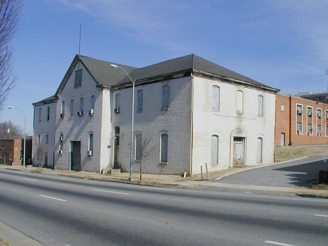
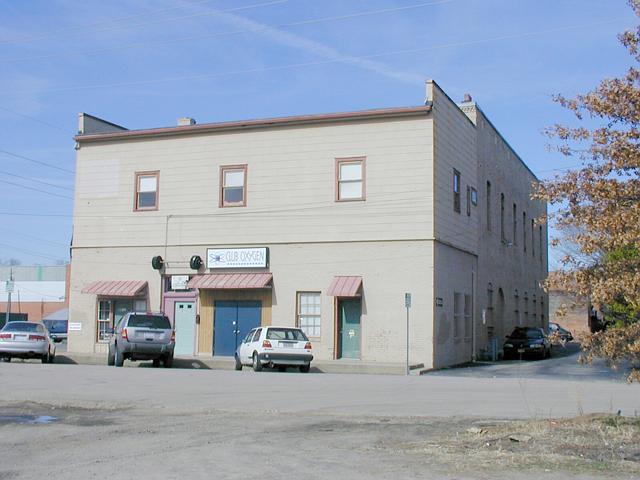
The maturation of a storage and distribution section occurred within close proximity to the Norfolk-Southern and Raleigh and Gaston railroad tracks in southwest Raleigh. Along Davie, Martin, West and Harrington streets, sand, gravel, and lumber lots intermingled with factories, warehouses and boarding houses. Through continual expansion, a few of the largest spaces were occupied by the more successful industrial enterprises such as Thomas Brigg's Sash and Blind Factory (1870s), and the North Carolina Cotton Oil Company (before 1888). The latter building is the earliest remaining structure in the area, at 406-412 West Davie Street. The New York-owned oil company continued to expand its operation between 1900 and 1914. Previously in 1896 the firm had converted from gas to electric lights and burned coal for fuel. The two-story, brick, flat-roofed structure housed the press room on the first floor and lint room on the second story. The same company owned the nearby guano warehouse which faces Harrington Street and had its gable-roof shaped attic space converted to a second story to facilitate the firm's operations.
 |
 |
 |
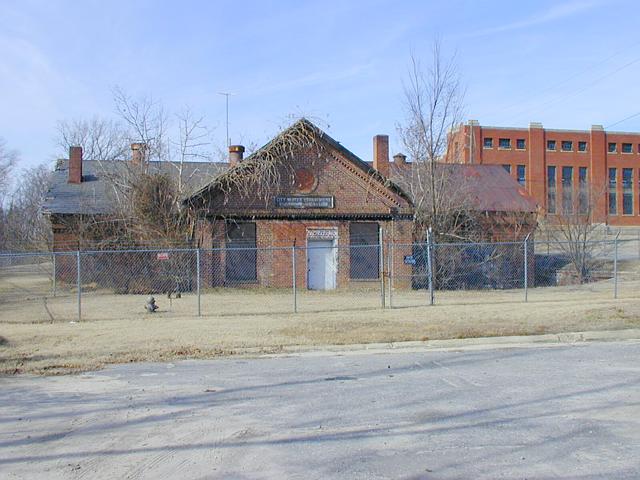
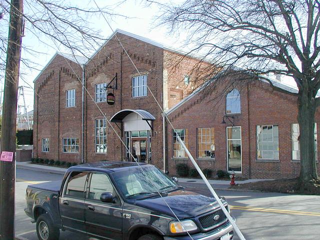
Another railroad-related area grew up northwest of the city center also on the Norfolk-Southern Railway line. Here, affirmation of the drawing power of the railroad and continued filling of the city's boundaries came in 1908 when the Norfolk-Southern Railway Company constructed a passenger and freight depot at 518 West Jones Street. The two-story, flat roofed, orange brick structure was strategically located at the corner of West Jones and Glenwood Avenue, then known as North Saunders Street. The area of West Jones Street between Glenwood Avenue and North Harrington Street grew to become a transportation and electrical convergence point. At this location, the two railroad companies' tracks were parallel for roughly eight hundred feet. [14] The transfer of goods and passengers took place here. In turn, the railroad companies had formed a lasting relationship with the electric streetcar utility which was owned by the Carolina Power and Light Company (CP&L). A block-long spur was built from the Hillsborough streetcar route, northwards to the passenger station. Thus, a traveler could alight from the railway train and walk to the electric streetcar or vice versa within a short distance. [15]
 |
 |
 |
 |
Still standing at 133-135 Fayetteville Street is the Masonic Temple
 |
Several years later, the Commercial National Bank Building, rose at 14-20 East Martin Street. The ten-story building was designed by P. Thornton Marye, an Atlanta-based architect, and for two years, 1913 and 1914, it was Raleigh's tallest building. The elegant skyscraper, which featured rich Gothic Revival details such as pointed arch doorways and stone-carved heads and gargoyles, was destroyed by implosion on March 24, 1991.
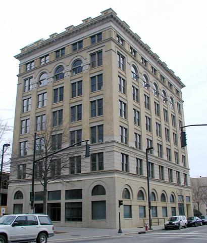
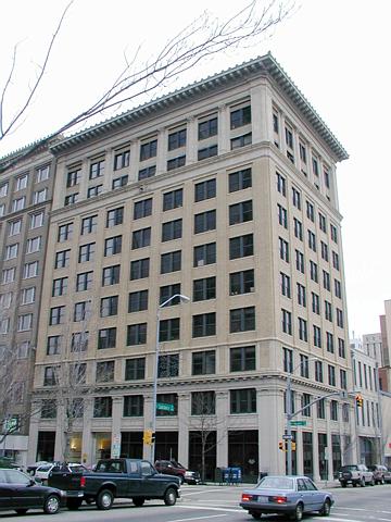
Although tall office buildings were highly visible in a city where two and three story structures were the norm, they were also very costly. only large and ambitious companies -- often banks -- could afford to erect structures of seven or more stories. In 1914, the Citizens National Bank Building supplanted the Commercial National Bank's status as the tallest building in Raleigh. [20] The classical, eleven-story structure occupied the northeast corner of Martin and Fayetteville streets until it was razed in the early 1960s. The skyscraper epitomized the business community's pursuit of a powerful corporate symbol which led ultimately to the conquest of the capital city's skyline. The increasing availability of downtown office space left some skeptics unsure if there would be enough business and people to fill the vacant buildings. [21]
But in fact the economy prospered, and people moved to the city to find employment and housing facilities. Many sought to rent living quarters and for many years could only rent rooms in private homes, live in hotels, boarding houses or rental properties. During the first decade of the twentieth century, as a building type, the apartment house, did not exist in Raleigh as city directories indicate. Between 1911 and 1913, the Park (or Old Raleigh) Hotel formerly located at the corner of McDowell and Martin Streets overlooking Nash Square was converted into Raleigh's first apartment house. Although the building had not been designed as a multiple-family dwelling, it was a successful venture. [22]
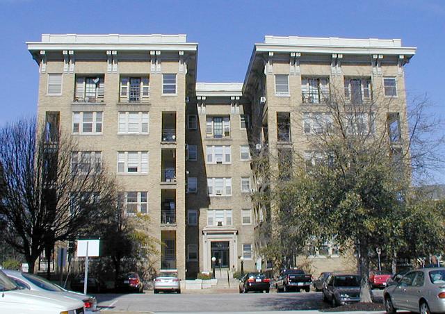
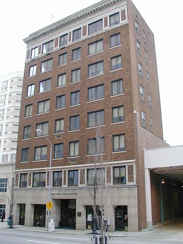
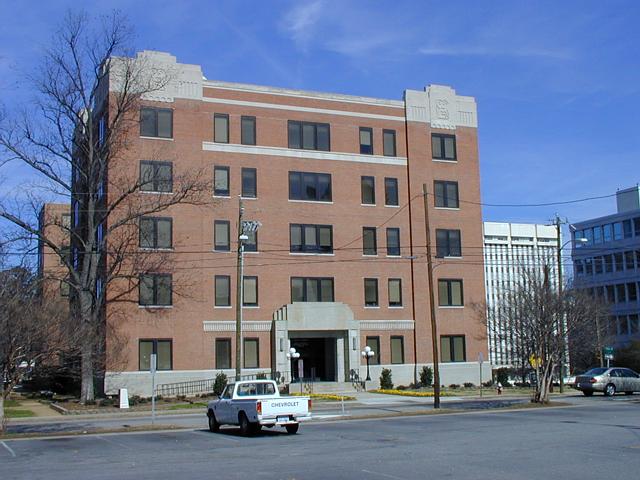
Raleigh's first true apartment building is the five-story, yellow-brick, U-shaped, Capital Apartments
 |
 |
 |
 |
 |
A major chapter in Raleigh's early years of the twentieth century was the creation of three planned suburban neighborhoods, Glenwood, Cameron Park, and Boylan Heights. All three of these suburbs were platted between 1906 and 1910 on lands situated to the north, west, and southwest of the 1907 expanded city limits. Although the neighborhoods were designed to attract Raleigh's newly arrived or those newly ascended to the middle class, they vary in their layout, architecture, and topography. From the outset, these neighborhoods had water and sewer services, electric power and access to streetcar transportation which were vital amenities to the new city dwellers. [26]
In addition to the white suburbs, black residential expansion continued at an unprecedented rate in the south and east sections of Raleigh. South Park, bordered by Bledsoe, Wilmington, Hoke and East streets, was platted in 1907 by the white-owned Raleigh Real Estate and Trust Company. Soon after, in a twelve month period, 122 lots had been sold and were in various states of improvement. Farther to the north and east, around St. Augustine's College, two other black suburbs were created in the early 1910s. Battery Heights and College Park attracted skilled workers and a rising middle class sector. The domestic architecture consists of one and two story frame Triple A's and shotguns, cottages and I-houses decorated in a variety of styles. Although South Park, Battery Heights and College Park were in outlying areas, by 1920, streetcar service along Hargett Street was extended and an increased use of automobiles attracted would-be homeowners. [27]
Besides providing improved access to the outlying residential areas, the Carolina Power and Light Company (CP&L) sought to expand its ridership base. In 1911, the utility extended northward the Glenwood Avenue route to the Carolina Country Club which bordered a one hundred acre park. Bloomsbury Park opened in 1912 and featured an electric powered carousel, a roller coaster and a penny arcade. The general manager of CP&L reported, "we now have a long railway line for joy riders which terminates at the park and we are hopeful that the combination will prove most beneficial to us". [28] By 1915, however, Bloomsbury Park had ceased operations, terminated by CP&L.The carousel was bought by the city and placed in Pullen Park. What was left along both sides of the rail lines was mainly farmlands filled with cultivated fields, fallow expanses, and woods that had been ogled by every paying passenger up to that time. In mid-decade, continued residential expansion occurred when large plots of land were purchased by Thomas Ruffin, James H. Pou, and others. Situated north of the Five Points intersection, the lands would beckon to prospective homeowners for several more years until the outbreak of World War I temporarily suspended development.
By the end of the 1910s, Raleigh's commercial, industrial and residential areas expanded into separate and distinct enclaves. The form of the commercial district had begun to change as early as 1907 when building technology and maximum space utilization allowed more floors and offices to be added to a building. The urban core became more dense and business activities intensified as education and government and commerce drew workers to the city. Industry pursued the valuable areas located near surface transportation networks. Raleigh supported six textile mills, two railroad companies and scores of factories, warehouses and livery stables. In addition to office workers, another kind of labor force skilled in mechanical operations and manual trades was necessary to keep pace with competing towns and cities. With the 1907 expansion of the city limits came a rush of citizens to populate the outer fringes of the central business district and industrial sections. The electric streetcar provided the impetus to develop outlying acreage in areas that were away from the noise, pollution and crowding and that promoted living together in socially homogeneous neighborhoods.
The Decade of the 1920s: 1920-1929
Soon after the end of World War I, Raleigh experienced increased residential and commercial development in almost boom proportions. Building upon city leaders' pre-World War I successful attempts to attract commerce and industry, growth was unabated in the 1920s. Expansion of Raleigh's distribution functions continued in the warehouse district, the CP&L Company and Norfolk- Southern Freight Depot along West Jones Street and northward on Wake Forest Road. Government and educational institutions also expanded in this era. State College erected several new buildings, mainly in a red-brick neoclassical style, and in 1925 Meredith College moved to a rural site three miles west of the Capitol where the college developed a campus of restrained red brick neoclassical buildings. By 1925, there were fifty-seven manufacturing enterprises, thirteen public schools, six buildings with over four stories, and 5,210 registered automobiles. In addition, a massive civic improvements campaign was undertaken to upgrade amenities such as 25 miles of paved roads, an expanded water system, and continued electrification of outlying areas. Besides the commercial development in the urban core, residential growth in the north, northwest, and west sections was influenced, in part, by the expansion of the city limits in 1920. During the most prolific stage of development, between 1922 and 1924, nearly seven hundred houses were erected. [29]
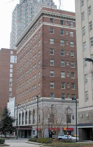
The majority of new homeowners were employed in Raleigh's mushrooming central business district where downtown office space doubled between 1920 and 1930. Besides numerous smaller structures, three tall commercial buildings erected between 1923 and 1924 effectively propelled downtown commercial development. They were the ten-story Odd Fellows Building (19 West Hargett Street), the eight-story Lawyers Building (320 South Salisbury Street), and the ten-story Sir Walter Hotel (400-412 Fayetteville Street). They continued the use of classical column organization of a tall building. The simply detailed, Federal Revival Lawyers Building boasted one hundred percent occupancy by 1925. The Odd Fellows Building and the Sir Walter Hotel are more elaborately Neo-Classical in style; the latter was designed by James A. Salter and constructed by C. V. York. The hotel was home to legislators and lobbyists who influenced the state's political history. [30]
 |
 |
 |
Likewise essential to the city's commercial architecture are the smaller, one-, two-, and three-story store front buildings which still remain on parts of Hillsborough Street, South Salisbury Street, Wilmington Street, North Person Street, and Glenwood Avenue. The majority are flat-roofed and composed of masonry construction. Nestled downtown in one of the few remaining commercial blocks is the Parker-Hunter Realty Company building at 128 South Salisbury Street, which features a Neo-Classical store front with a carved stone cornice, pilasters, and window sills, crowned by a monogrammed medallion centerpiece. An example of a neighborhood commercial structure is situated in Five Points at 1801 Glenwood Avenue, the Flat Iron Building , ca. 1922. The two-story, painted brick structure derives its name from the wedge-shaped site and floor plan. Its original function is still maintained, with retail space on the first floor and six apartment units on the second story.
 |
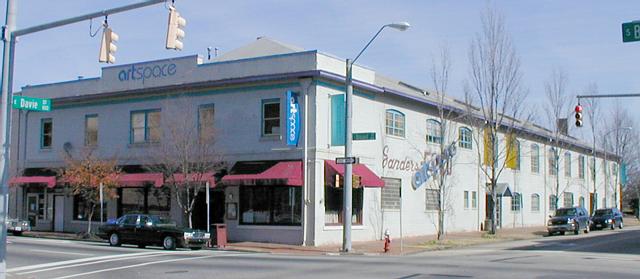 |
Auto-related commercial building types likewise stood near the central business district and at outlying intersection. Two early twentieth century auto showrooms remain: the Hoover Buick Company (now Raleigh Furniture), at 118 West Hargett Street (ed: demolished 2000), and the Sanders Ford (now Artspace, Inc.), at 201 East Davie Street. About a dozen filling and repair stations survive from the 1920s. One of the most intact is found at the corner of Oberlin and Fairview Roads--the Budleigh Service Station , c. late 1920s, a brick, flat roofed building with a pressed metal cornice and a porte cochere, adorned by the juxtaposition of cream and red bricks below the pier caps. The most ornate automobile-related structure is the Firestone Tire and Rubber Company garage at 201 West Martin Street. The garage, erected around 1928 by James Davidson, the local building contractor, has Art Deco style elements in the decoratively capped piers and striated bronze window surrounds. The striking design and prominent locations of such buildings were intended to attract passing drivers into the establishments. These two components were part of a pattern adhered to by national hotel, gasoline and restaurant chains, which became popular in the post World War II era.
 |
 |
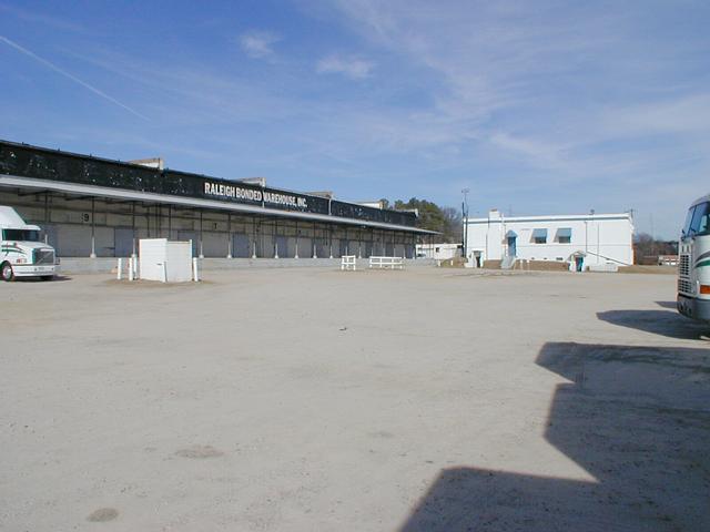
The final grouping of commercial buildings erected during the 1920s construction boom are distribution and storage structures. In an effort to lure new and diversified manufacturing establishments, the city fathers continued to advance the idea of becoming a distribution center. [31] By providing increased transportation facilities, the Chamber of Commerce, among other interested parties, sought to encourage successful enterprises to locate their storage and distribution facilities in the capital. Three such establishments that settled in Raleigh during this time were the Pine State Creamery, the Gulf Petroleum Products Warehouse, and the Raleigh Bonded Warehouse -- all located on the Norfolk-Southern Railroad line.
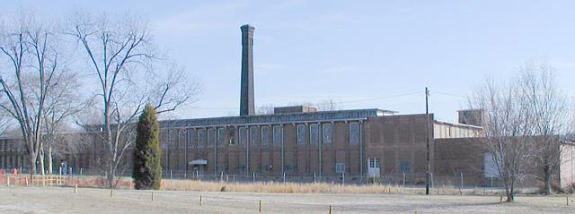
In 1927, the Pine State Creamery moved into its new dairy plant at 426 Glenwood Avenue. Although the company began in 1919 at a downtown location, the dairy had outgrown its capacity. The two-story, cream-colored brick, structure was constructed by James Davidson. Proximity to the Norfolk-Southern Railroad (NSRR) tracks provided the means to transport incoming raw and outgoing finished milk products. The processing plant has wide bays on the north elevation for the loading of trucks. The original structure has been incorporated into the larger site, suffered two fires, and had many openings bricked over. [32]
Locations of the oil and cotton warehouses also took advantage of the surface transportation networks. Two key examples stood north of the city limits near rail lines. The Raleigh Bonded Warehouse
 |
 |
One of the most dramatic manifestations of 1920s growth in Raleigh was residential development. Inside the new (1920) city boundaries, previously established suburbs were intensely built up, while vacant lands were targeted for a second wave of subdivisions. An example of the infill pattern is especially noticeable in Raleigh's south and east black-occupied neighborhoods. The old boundaries remained unchanged in this part of the city, yet many of the streets were paved and water and sewer lines were installed. These improvements combined with greater streetcar access encouraged substantial building in the suburbs of South Park, Battery Heights, and College Park. [34] Subdivisions illustrating the expansive type of residential development are situated along the streetcar routes in north and west Raleigh, on land that had been cotton fields, cow pastures, and the grounds of the North Carolina State Fair. These areas are: Hayes Barton, begun in 1920, Roanoke Park and Mordecai, both 1922, to the north and College Crest, 1922, Wilmont, 1924, and Fairmont, 1926, in the west.
Northern suburbs flourished around the Five Points intersection in this era. Bloomsbury and Georgetown which had been platted before and after World War I, were the earliest settled neighborhoods. In Bloomsbury, the first roads carved out of the land were given names that instilled a sylvan image such as Myrtle, Woodland, and White Oak Forest (shortened to White Oak) roads. The electric streetcar provided fast access for the commuters who moved here. Between 1920 and 1922, thirteen dwellings had been erected inside and beyond the city boundary on either side of Glenwood Avenue, north of Five Points and past the older Glenwood neighborhood and the Methodist Orphanage. Five of them were located along the streetcar route. They are one- and one-half and two-story, frame and brick foursquares and gable-roofed bungalows. The owners and neighbors were upper management and businessmen. And yet, a five-or ten-minute walk away from Glenwood Avenue on the side streets of Alexander or Creston roads were found homeowners with occupations such as meat cutters and managers, foremen and clerks.The houses were brick and frame bungalows and Colonial Revival houses with a wide range of architectural massing and details. Due to this mixture of inhabitants and dwelling designs, Bloomsbury grew to become an economically diverse neighborhood.
The other early 1920s residential development, situated east of Bloomsbury and north of the Norfolk-Southern Railroad tracks, was Georgetown. The land, owned by James H. Pou, developer of Glenwood, was platted in the 1910s. City Directories reveal that railroad workers occupied this stretch of the road. Significant examples of workers' housing still remain on Sunrise Avenue. One of the most intact is at 1512 Sunrise Avenue
 |
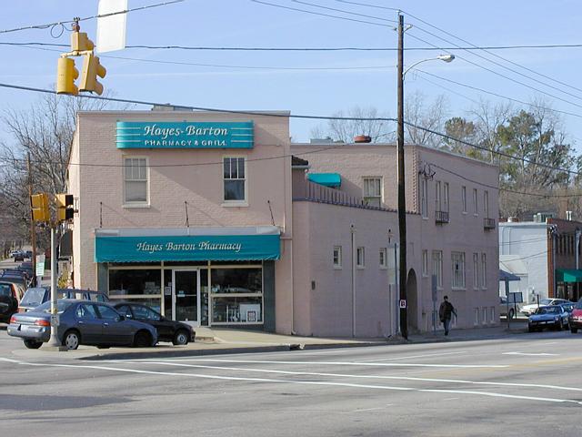
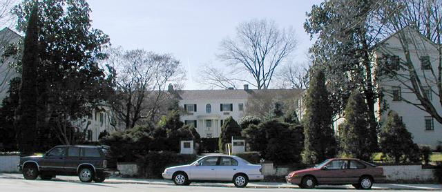
By contrast, the grandest of the second wave of suburbs is Hayes Barton, Raleigh's first twentieth century upper-class neighborhood. Bordered by Glenwood Avenue, Fairview Road, Williamson Drive, and St. Mary's Street, Hayes Barton is an exclusive residential district where pecan and willow oak trees shade Georgian and Colonial Revival houses along streets that bear the names of former North Carolina governors such as Jarvis, Reid, Stone, and Vance. The earliest house here dates back to June, 1920, when the suburb developed by the Allen Brothers and the Fairview Realty Company began its transformation from the cotton fields of B. Grimes Cowper. Marketed specifically towards the high end of the economic scale, Hayes Barton was named for Sir Walter Raleigh's birthplace in Devon, England.
Hayes Barton is one of several upper and middle-income suburbs in North Carolina designed by Earle Sumner Draper, a distinguished landscape architect. His layout of Hayes Barton was similar in overall character to Myers Park in Charlotte; in 1911, John Nolen, a pioneering city planner, had created the Myers Park design which was a highly influential diagram for spatial and social organization throughout the south. There, Nolen formulated components for a successful suburban enclave such as curving streets, greenway parks, streetcar transportation, and a restricted number of entrances. [35] Hayes Barton appealed to the well-to-do with its promise of privacy, large wooded lots, and commuting distance to downtown Raleigh.
Soon after utility linkages and paved roads were installed, there was a rush to build on the 175 acres. The design of the 1920s housing stock followed traditional and popular tastes, mainly large Colonial Revival houses. The majority of dwellings are two stories tall, built of masonry, with gable roofs and handsome restrained classical details. A substantial proportion of the houses are custom designs by local architects such as Thomas W. Cooper, William H. Deitrick, Charles Atwood, Arthur C. Nash, and James A. Salter. The most prolific builders in Hayes Barton were James A. Davidson, C. V. York, Howard Satterfield, John W. Coffey, and Roland Danielson. In some cases these men built from architects' designs, but some, such as Satterfield, designed as well as built houses. Nearly half of all the dwellings in Hayes Barton were erected during the 1920s; they were inhabited by insurance agents and bankers, physicians and attorneys, salesmen and administrators, many of whom were employed in downtown Raleigh. Hayes Barton was and is an area of impeccably manicured landscapes, and pristinely maintained residences which still house some of the capital city's political and social leaders.
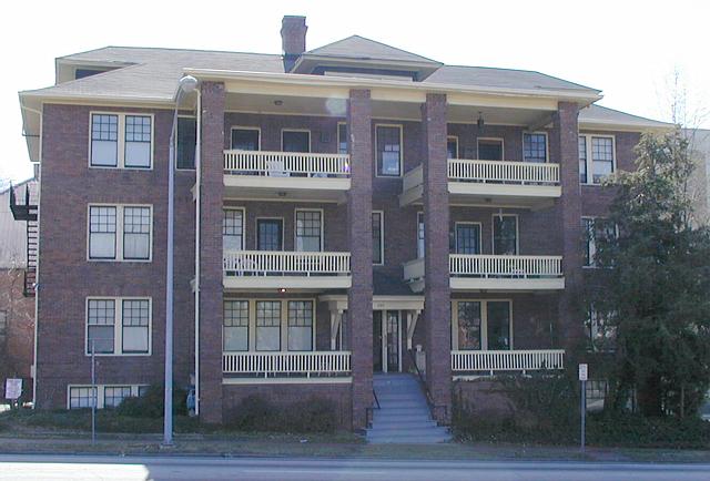
Another form of residential growth came with an increase in the number of apartment buildings during the 1920s. By 1925 there were eleven such structures strategically located near busy intersections and in outlying suburban areas. [36] The apartment houses varied in size, fenestration and height. Downtown were the Vance Apartments (razed in 1990), sited at the corner of East Edenton and Wilmington Streets and built in 1920, and the Bailey Apartments , also on East Edenton Street, built in 1923. Following the westward trend of residential development, the Irene and the Hart Apartments, were built ca. 1922 and 1924, respectively, at 7-9, 11-15 Glenwood Avenue (ed: no longer exist), and they took the form of brick rowhouses. In the late 1920s, the most westerly apartment building was the Wilmont Apartments at 3200 Hillsborough Street, a four-story, brick, U-shaped, flat-roofed structure that housed twenty-four one-and two-bedroom apartments. The Wilmont was the first of its type constructed west of the North Carolina State College campus and south of the newly created suburb, Wilmont, from which it derives its name. Some of the occupants were white collar workers and employed downtown who relied upon private automobiles and public transportation for conveyance to and from their jobs. Others were associated with nearby State College and Meredith College. [37]
 |
 |
The Years Before World War II: 1930-1941
In January 1929 the nation seemed to be prosperous, but before the year ended economic disaster had begun with the stock market crash in October, which was followed by the Great Depression. In the decade between 1930 and 1941, the building economy plummeted, then gradually improved from extremely low levels of construction to an upward swing at the decade's end. Nationally, between 1928 and 1933, the construction of residential property declined by 95 percent and expenditures on home repairs fell by 90 percent. In Raleigh, between 1930 and 1936, the worst years of the Depression, an average of 125 permits were issued at an average total value per year of $457,000. In 1930, 182 houses were erected: in 1931, only 54 dwellings were built, and in 1932, only 34. Recovery came between 1937 through 1941, when an average of 241 permits per year were issued and the average annual value of the new construction was worth $2.5 million. [38] As these numbers indicate, the Recovery era buildings represent a tremendous proliferation of construction, and this resulted in rapid filling-in of suburban neighborhoods and inner-city areas as well as continued outward expansion of the city's suburbs.
 |
The dominant residential form of the Recovery Era are houses which reflected economical use of materials and labor, recently termed "minimal traditional" dwellings. These typical Recovery era houses are characterized by their reduced architectural detailing, smaller scale and mass, and the facade treatment of modestly projecting entry ways, gables and chimneys. These houses appear with regularity all over Raleigh, but are especially concentrated in Wilmont and Forest Hills (two subdivisions in West Raleigh) and Anderson Heights, Budleigh, and the northern edge of Bloomsbury. An especially fine collection of minimal traditional dwellings is found along the north and south sides of the 2700 block of Van Dyke Avenue in Forest Hills. Constructed on small lots between 1939 and 1940, twenty frame structures on this block are mainly one-story, simplified Colonial Revival houses with 6/6 windows, interior and exterior brick chimneys. In 1941, occupants of the housing were mainly newly hired State College faculty, office workers, and tradespeople.
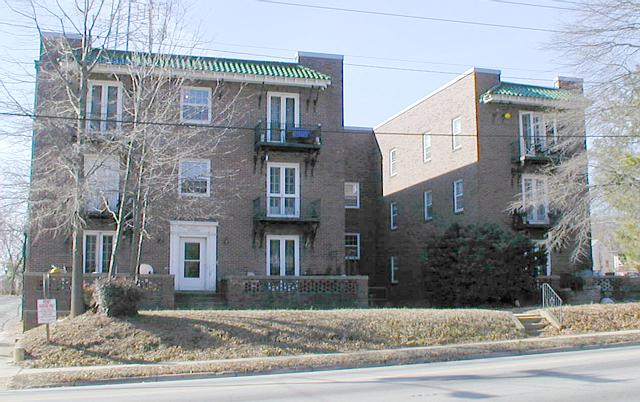
New apartment houses were also erected in this era. Six were built between 1934 and 1939, on or near Hillsborough Street. Owners of the large Boylan and Cameron estates sold off large parcels of land which became the sites of Boylan Apartments, Cameron Court Apartments, Grosvenor Gardens Apartments, and the Raleigh Apartments. Also, located on Hillsborough Street are the St. Mary's Apartments , 8 St. Mary's Street and the Fincastle Apartments , 3109 Hillsborough Street. The U-shaped building at 1101 Hillsborough Street, Grosvenor Gardens Apartments, was the third of three large complexes constructed within a three-block area along Hillsborough Street. The three-story, painted brick, gable roofed building represents the epitome of well-planned siting. The owner and developer, Sidney J. Wollman, originally from Westchester, New York, drew upon previous experience for the design. Wollman termed its style "Georgian Colonial" in a Raleigh Times article, and claimed it was the first time in Raleigh that the design had been employed on such a large scale. Local architect James M. Edwards, Jr. put the design on paper and G. Robert Derrick did the landscaping for the garden to complement the apartments. [39]
 |
 |
 |
 |
Besides the public housing units, other federally-funded building
projects of the Recovery Era are located in downtown Raleigh.
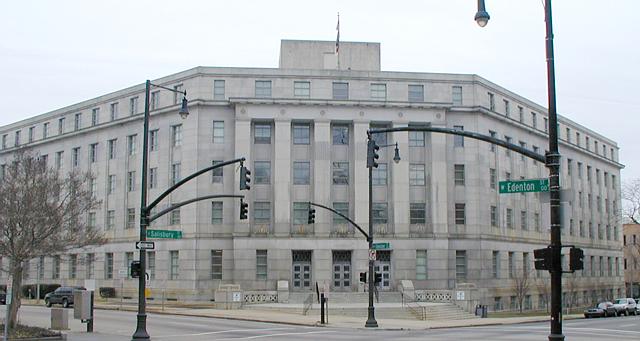
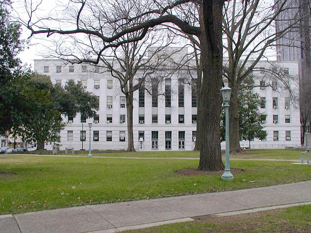
The Education Building
, 1938, at the corner of Edenton and
Salisbury Streets and the Justice Building
, 1940, at 10 East
Morgan Street are the most elaborate Works Progress
Administration-assisted structures. The largest cluster of Recovery era
government buildings is located on Caswell Square, the former
site of the North Carolina School for the Blind and Deaf. There
are three utilitarian warehouses, the State Hygiene Laboratory,
and the Caswell Office Building. The latter two buildings,
constructed in 1939, demonstrate the juxtaposition of varying
architectural styles. The Clarence A. Shore Laboratory of Hygiene
 |
 |
 Clarence A. Shore Laboratory of Hygiene |
 |
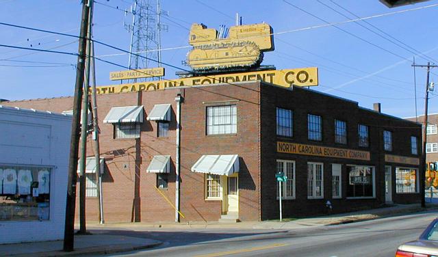
There was also a resurgence in construction in the commercial sector. (The importance of Raleigh as a distributing center was verified when, in 1939, the heads of l3l out of 429 -- nearly one third -- newly relocated families were engaged in retail and wholesale distribution. Only 84 new household heads, or twenty percent, were employed in government agencies.) The established distribution and storage sites, the warehouse district and the West Jones Street area, slowly lost their monopoly to Hillsborough Street, in particular the area between N.C. State College and Meredith College. By locating both inside and beyond the old city limits, the manufacturing and service industries had begun in the 1930s to take advantage of congestion-free downtown areas and the absence of zoning and building restrictions. [42] The North Carolina Equipment Company at 3101 Hillsborough Street started the advance to the west around 1934 erecting a substantial brick building, whose distinctive caterpillar sign atop the roof has been a favorite west Raleigh landmark since after World War II. By 1942, there were also an electrical equipment company, a laundry, a warehouse, a bakery, and a bottling plant. The most stylish of these industrial buildings is the latter structure, The Raleigh Nehi Bottling Plant, at 3210 Hillsborough Street. Designed by architect William H. Deitrick, the two-story, flat roofed Art Moderne building has a black Bakelite entry way and a glazed white brick facade.
 |
 |
During this time, in West Raleigh, the water supply was hard pressed to meet the demands of increased suburban and industrial development. Fortunately, after the Depression, plans were prepared by the engineering firm, W. C. Olsen, Inc., for new facilities at the old Walnut Creek treatment plant site. The new facilities, named after Raleigh's first water works superintendent, Ernest Battle Bain, were completed in 1940 and had the capacity to treat eight million gallons of water a day. The large, red brick and cast stone detailed structure has Art Deco design elements such as a strong vertical emphasis, inset windows, and striated brickwork patterns. [43]
 |
By the beginning of World War II Americans had undergone a decade of hard times. In the first half of the 1930s the entire nation was in the grip of the Great Depression, as all aspects of life were radically affected in that employment and housing were scarce, and people went hungry. The mid and late 1930s, however, brought a period of recovery and economic rejuvenation as evidenced by industrial and office buildings and a growing supply of new housing. During these years the capital city had grown in size and population, reflected in city limit extensions in 1920, 1929, and 1941. The population had almost doubled from 24,418 people in 1920 to 46,897 citizens in 1940. The municipality had kept pace with the influx of people by improving capacities of the existing water, electrical, and road systems. By keeping abreast of business activities, the city fathers had succeeded in moulding Raleigh into a vital distribution hub as well as an educational and government center. Raleigh was well out of the depression when America entered World War II on December 7, 1941.
The Mid Twentieth Century: 1945 - 1970
During World War II, with shortages and rationing of food, labor and materials, construction again tapered off dramatically; for example in 1943, only 30 building permits were issued at a value of $134,218, as compared to 81 permits issued in 1934, one of the worst years of the depression. Residents accommodated neighbors and newcomers by converting single-family dwellings into apartments. Families doubled up with relatives and friends and persevered with the shortages.
After the Japanese surrender brought the end of World War II in 1945, one of the most pressing problems of peacetime was to meet the housing shortage. The federal government responded by underwriting a sweeping residential construction campaign. The creation of two mortgage programs, one for the Federal Housing Administration and the other for the Veterans Administration, stimulated an unprecedented building boom. The number of national residential construction starts, which amounted to only 114,000 in 1944, had reached an all-time high by 1950 of 1,692,000. In Raleigh, the number of building permits spurted from only 41 in 1944, to 544 in 1946, to 857 in 1948, and 989 in 1950. [44]
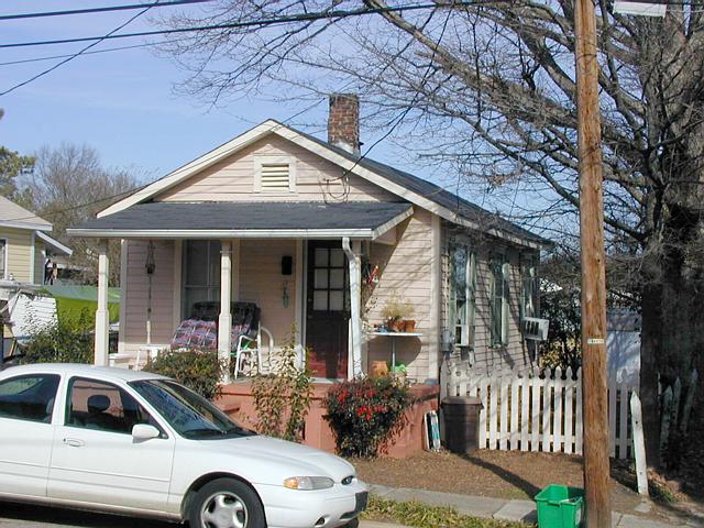
The building of homes in Raleigh in the immediate postwar years occurred in neighborhoods inside and beyond the city limits. Pockets of FRA and VA housing were constructed in Oakdale, Mordecai, Georgetown, Vanguard Park, Anderson Heights, Budleigh, Wilmont, and College View. The houses range in size, form, and materials. For example in Georgetown, lining the north and south sides of New and Georgetown roads, are single story, frame, gable-roofed, VA houses with flush gables and diminutive facades. The lots are deep and narrow, only 50 to 55 feet wide at the building line. The houses share the same floor plan: kitchen, living room, two bedrooms and bath off a center hallway. The Georgetown houses were affordable - only $200 down with the rest, $6,000, financed by a government loan. [45]
Farther from the railroad tracks in the sparsely populated neighborhoods of Anderson Heights, Budleigh, and Fallon Park, larger minimal traditional houses were rapidly constructed. These FHA dwellings differed from their VA counterparts in a crucial way: the FHA promoted the housing for the benefit of urban middle- income people. In order to achieve "neighborhood stability", the FHA succeeded in imposing construction and design controls. In effect, the character of a neighborhood depended primarily on the overt policies of racial segregation. [46] Consequently, in the south and east areas of Raleigh, the majority of housing was constructed with little, if any, assistance from private lenders or government loans.
 |
Several of these architects were influenced by the patriarch of
modern American architecture, Frank Lloyd Wright, while a few,
including George Matsumoto, as well as non-faculty architects G.
Milton Small and to a lesser degree, William H. Deitrick, were
affected by the International Style, whose advocates were
Europeans Walter Gropius and Ludwig Mies van der Rohe. The hallmarks
of Wright's Prairie style are elements such as large stucco or
wood panels, harmonious blending of natural materials, and
cantilevered roof or porch planes. These qualities are evident in the
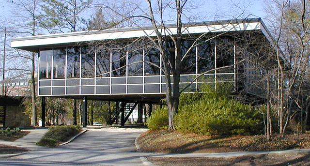
house at 3060 Granville Drive
which Kamphoefner designed for
himself, especially in the rear porch. Similar themes appear in
Fitzgibbon's house design for George Paschal. Built in 1950 and
located at 3334 Alamance Drive
, the dwelling is an exercise in
the close relationship between the land and the structure. The
very low unobtrusive roofline complements the hillside, and the
naturalness of the landscape is reflected in the materials
selected for the house.
 |
 |
 |
Paralleling thriving residential development in the suburban ring during the 1950s and 1960s was an intense focus on commercial building. Commercial architecture was characterized by a confident and enthusiastic desire to get on with the business of progress. Consequently, architecture became an increasingly important form of public relations. [48] In postwar Raleigh, the largest embodiment of changing civic and social life while selling merchandise was the development of the region's first planned shopping center. In 1947, the last remaining 158 acres of the former Duncan Cameron estate were made available to C. V. York. Thus, the Cameron Village Shopping Center was created to serve the existing community. Chief architect Leif Valand designed the initial clusters of brick, flat roofed buildings on the north and south sides of Cameron Street, bordered by Daniels Street and Woodburn Road. [49] His work was patterned after the Country Club Plaza in Kansas City, Missouri, which was developed by J. C. Nichols in 1928. The layout of the shopping center was focused on six square blocks connected by intersecting streets.
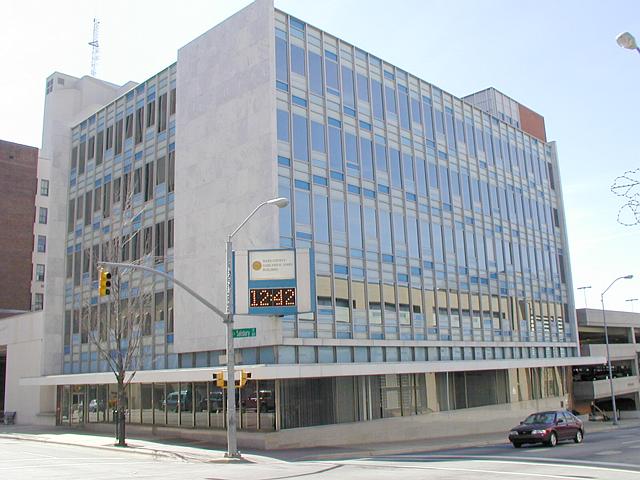
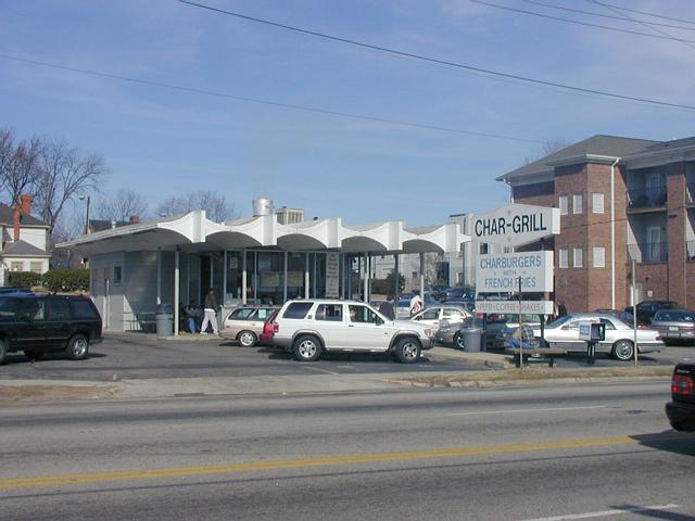
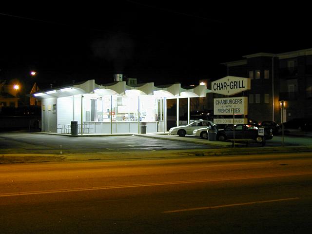
In Raleigh's central business district, newly constructed buildings were easily recognizable because they stood apart from the visual order of their surroundings. [50] Three examples of modern urban structures have their roots in the International Style: the Wake County Social Services Building, 1950, 201 West Davie Street (ed: demolished 1998), designed by William H. Deitrick; the First Federal Building, 1961, 300 South Salisbury Street, designed by St. Louis architect Howard T. Musick; and the Char-Grill, 1960, at 618 Hillsborough Street, designer unknown. The buildings draw attention with such features as ribbon windows, multicolored glass panels or concave roof shapes. These particular examples are also remarkably intact making them some of the most pristine instances of commercial architecture in the popularized International Style in the capital city.
 |
 |
 |
The influences on Raleigh's modern architecture came from outside sources just as in previous decades when the Victorian style was in vogue. The style makers who came to North Carolina's capital brought with them the knowledge of the latest trends in the major cities such as Atlanta or Washington, D.C. But, Raleigh's public officials and private sector businessmen wavered between being architectural leaders of fashion or remaining followers. They desired the image of the fancy buildings from the large metropolises although toned down and with a little less polish. So, with little exception, the architects and designers, engineers and builders of Raleigh were adept followers, rather than leaders of fashion; they adhered to traditional and popular tastes of the period. In general, building designs were selected for their broad appeal and unique association, two good reasons for maintaining statewide respect as the capital city of North Carolina.
PRIMARY SOURCES
Directories
Hill Directory Company 1910, 1915, 1920.
Polk's City of Raleigh Directory, 1900-1950.
City of Raleigh. Planning Department. "Annexation Information," Chronological Listing 1989.
City of Raleigh. Planning Department. "The Potential for Light Rail Transportation in Raleigh, North Carolina," N.A., N.D.
Raleigh Historic Properties Commission. Property Designation Application and Report. Capital Apartments, 1989.
State of North Carolina. Wake County Water Use Study. June, 1970.
North Carolina State University, D. H. Hill Library. Archives Department, Faculty Files.
Birdseye View of the City of Raleigh, North Carolina, 1872. City of Raleigh. Planning Department. Planimetric Maps, 1981, 1987.
Sanborn Insurance Company. Sanborn Insurance Map of Raleigh, North Carolina, 1888, 1896, 1903, 1909, 1914.
Wake County Recorder of Deeds, Plat Maps.
News and Observer, 1937, 1939 - 1941, 1951.
Raleigh Times, 1920, 1925, 1979 1979.
Ben Kilgore: December, 1989. Linda Tutor: July, 1991.
Russ Wollman: November, 1989.
Abbate, Charlotte, Pilot Mill National Register of Historic Place nomination. Section 8, page 3, 1989.
Brown, Charlotte V. "Three Raleigh Suburbs: Glenwood, Boylan Heights, Cameron Park. " Catherine W. Bishir and Lawrence S. Earley, eds. Early Twentieth Century Suburbs in North Carolina. Raleigh, North Carolina- Archives and History, 1985, pp. 31-37.
Hanchett, Thomas W. "Earle Sumner Draper: City Planner of the New South. " Catherine W. Bishir and Lawrence S. Earley, eds. Early Twentieth Century Suburbs in North Carolina. Raleigh, North Carolina: Archives and History, 1985,pp. 79. Harris, Linda and Mary Ann Lee. An Architectural and Historical Inventory of Raleigh, North Carolina. Raleigh, North Carolina: Raleigh City Planning Department, 1978.
Jackson, Kenneth. The Crabgrass Frontier. New York: Oxford University Press, 1985.
Lefler, Hugh T. The History of a Southern State, North Carolina. Chapel Hill, North Carolina: University of North Carolina Press, 1954.
Longstreth, Richard. The Buildings of Main Street. Washington, D.C.: The Preservation Press, 1987.
Mattson, Richard. "The Evolution of Raleigh's African-American Neighborhoods in the 19th and 20th Centuries." Xerographic copy, November, 1988.
Poppeliers, John C. What Style Is It?. Washington, D.C.: The Preservation Press, 1983.
Raleigh Chamber of Commerce. Industrial Survey of Raleigh, North Carolina. Raleigh, North Carolina: Chamber of Commerce, 1962.
Riley, Jack. Carolina Power and Light Company: A Corporate Biography, 1908-1958. Raleigh, North Carolina: Edwards and Broughton Company, 1958.
Roth, Leland M. A Concise History of American Architecture. New York: Harper and Row, 1979.
Solpen, Steven. Raleigh, A Pictorial History. Norfolk, Virginia: Donning Company, 1977.
Sumner, Jim. Sir Walter Hotel National Register of Historic Places nomination. Section 8, page 1, 1978.
Waugh, Elizabeth C. North Carolina's Capital, Raleigh . Raleigh, North Carolina: Junior League of Raleigh, 1967.
Wright, Gwendolyn. A Social History of Housing in America. Cambridge, Massachusetts: The MIT Press, 1981.
Writer's Program of the Work Projects Administration in the State of North Carolina. Raleigh: Capital of North Carolina. Raleigh, North Carolina: Sesquicentennial Commission, 1942.